St Petersburg transport map
You can find on this page the St Petersburg transport map to print and to download in PDF. The St Petersburg transportation map presents the transports network and transport zones of the transit of St Petersburg in Russia.
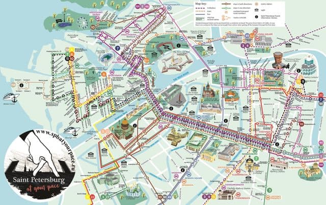
St Petersburg transports map
The St Petersburg transport map shows all means of transportation in St Petersburg. This transports map of St Petersburg will allow you to move easily with public transport of St Petersburg in Russia. The St Petersburg transportation map is downloadable in PDF, printable and free.
The first Russian railway was built here in 1837, and since then St Petersburg transport infrastructure has continued to develop and keep pace with the growth of the city. St Petersburg has an extensive system of local roads and railway services, maintains a large public transport system that includes the St Petersburg tram and the St Petersburg Metro, and is home to a number of riverine services that convey passengers around the city efficiently and in relative comfort.