St Petersburg tram map
You can find on this page the St Petersburg tram map to print and to download in PDF. The St Petersburg trams map presents the network, zones, stations and different lines of the tramway of St Petersburg in Russia.
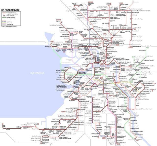
St Petersburg tramway map
The St Petersburg tram map shows all the stations and lines of the St Petersburg tramways. This tramway map of St Petersburg will allow you to easily plan your routes in the trams of St Petersburg in Russia. The St Petersburg tram map is downloadable in PDF, printable and free.
The city of St Petersburg, Russia once boasted the largest tramway network in the world, consisting of about 340 kilometres of unduplicated track in the late 1980s. Since 1995, the tramway network has seen a sharp decline in size due to the removal of major portions of track, particularly in the city centre; so St Petersburg lost its record to Melbourne, Australia. While it still had 285 km in 2001, the track extent in early 2007 was just over 220 km. It is operated by Gorelektrotrans (Russian: Горэлектротранс) as its shown in St Petersburg tramway map, a municipal organization that runs trams daily on 38 routes and also owns the trolleybus network.