

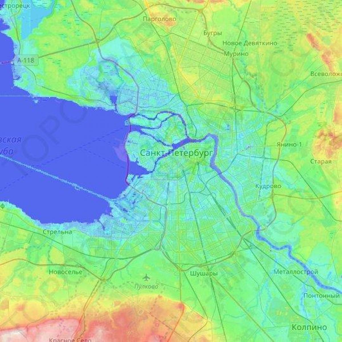
You can find on this page the St Petersburg topographic map to print and to download in PDF. The St Petersburg elevation map present the topography, river and relief of St Petersburg in Russia.

The St Petersburg topographic map shows elevation, hills and landforms in St Petersburg. This elevation map of St Petersburg will allow you to know topography, river and relief of St Petersburg in Russia. The St Petersburg topographic map is downloadable in PDF, printable and free.
The elevation of St Petersburg ranges from the sea level to its highest point of 175.9 m (577 ft) at the Orekhovaya Hill in the Duderhof Heights in the south as its mentioned in St Petersburg elevation map. Part of St Petersburg territory west of Liteyny Prospekt is no higher than 4 m (13 ft) above sea level, and has suffered from numerous floods.
Duderhof Heights or Duderhof Hills (Russian: Дудергофские высоты) is a small highland area in the southwestern part of St Petersburg (Krasnoselsky District), to the south of the town of Krasnoye Selo, on the northern edge of the Izhora Plateau, which consists of several hills, most notably, Orekhovaya hill (Russian: Ореховая гора, lit. Hazel Hill, 59°41′51″N 30°07′55″E / 59.6975°N 30.13194°E), the highest point of Saint Petersburg at 176 m (577'), in the south as you can see in St Petersburg elevation map.
Duperhof heights are a unique nature monument, a group of hills of glacial origin, the highest elevation place in the vicinity of St Petersburg as its mentioned in St Petersburg elevation map. The heights are formed by three mountains: Crow (147 m), Nut (176 m) and Kirchhoff (170 m). The first two vertices are on the same base. Near the Crows and Nut Mountains Dudergofskoe Lake is located.